Panorama Trail, from Pila


Edited by:
Massimo Martini
Updated at: 31/01/2026
Access
Lasciare lo svincolo autostradale di Aosta Est e svoltare a destra seguendo le indicazioni per Aosta centro. Proseguire per circa 4 chilometri e, giunti ad Aosta, svoltare a destra seguendo le indicazioni per Pila. Continuare per 6,9 chilometri fino a raggiungere la località Pont-Suaz, quindi prendere la seconda uscita e imboccare la strada regionale . Risalire la regionale superando l’abitato di Charvensod e, dopo 16,9 chilometri, si raggiunge Pila, dove è presente un ampio parcheggio gratuito (🅿️). Nei pressi della scala di accesso alla cabinovia è disponibile un fontanile (💧).
Accesso con mezzi pubblici
La località di Pila è raggiungibile con mezzi pubblici tramite cabinovia da Aosta, con collegamenti regolari e frequenti durante tutto l’anno. Non sono invece presenti collegamenti autobus diretti e regolari fino al parcheggio frazionale di Pila; per raggiungere il punto di partenza dell’itinerario è quindi necessario prevedere un trasferimento finale a piedi oppure l’utilizzo di un mezzo privato.
Distanza e tempo di percorrenza
🕒 Tempo di percorrenza: 37 minuti
📏 Distanza: 24 km
Navigazione GPS
📍 Come arrivare con Google Maps
📍 Come arrivare con Apple Maps
ℹ️ Nota importante
Le indicazioni fornite sono state verificate alla data del rilievo dell’itinerario. Prima della partenza, è consigliabile verificare eventuali variazioni del percorso. Per ottenere indicazioni aggiornate e dettagliate, si consiglia l’uso di Google Maps o Apple Maps.
Introduction
This is a pleasant, well-equipped itinerary along the mountainous backdrop of Pila. Take advantage of the ski lifts to enjoy a pleasant day on easy rocks amidst breathtaking views.
Description
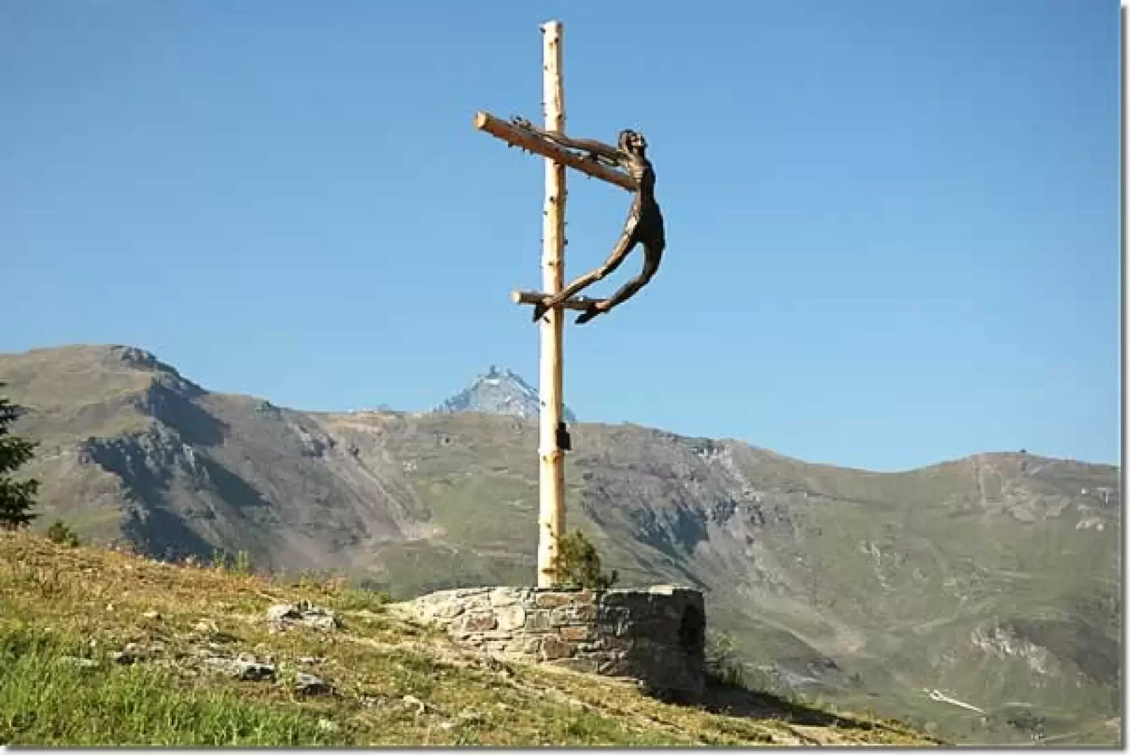
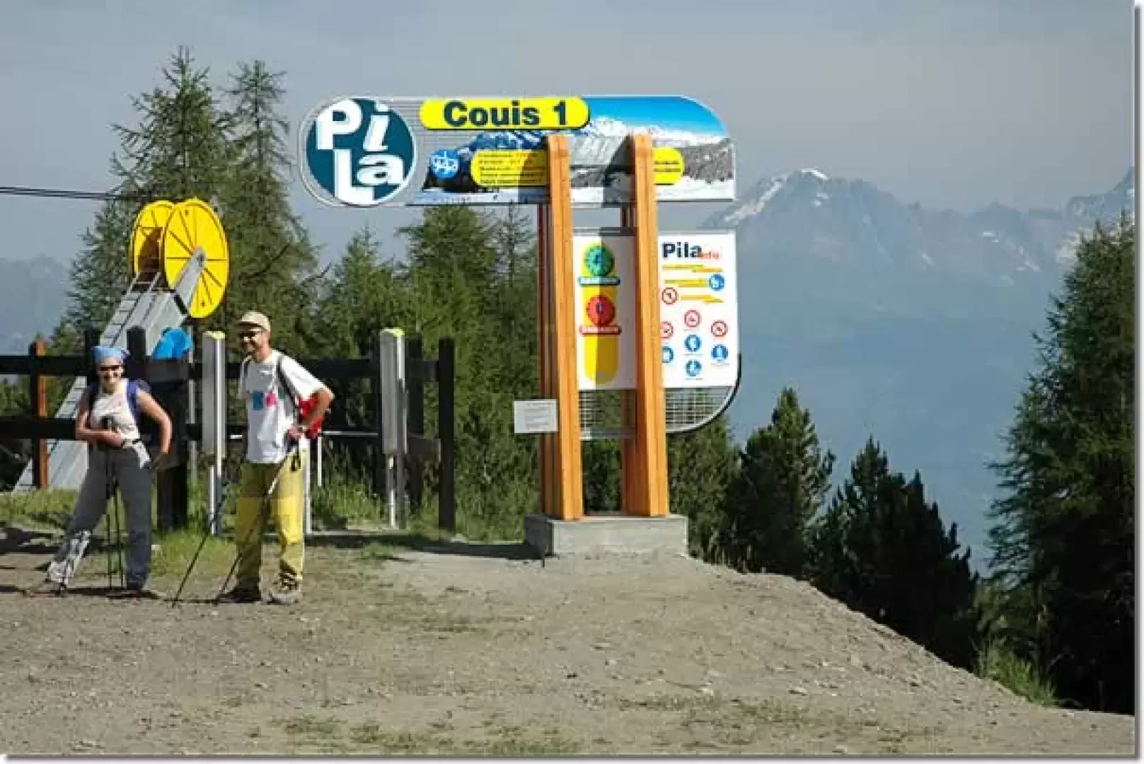
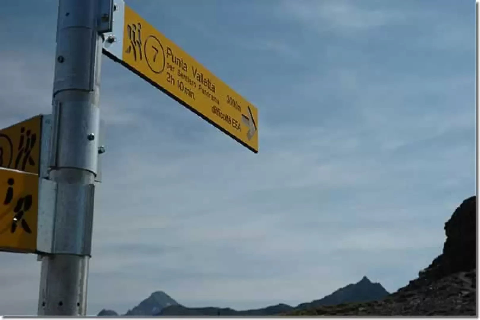
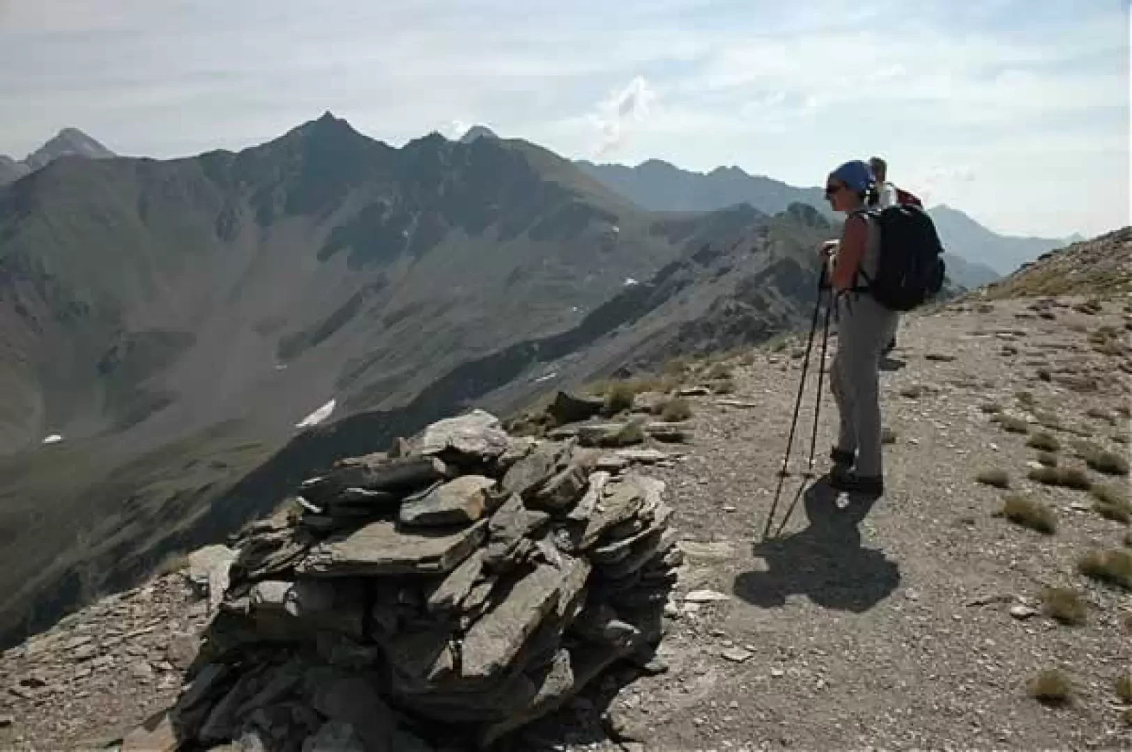
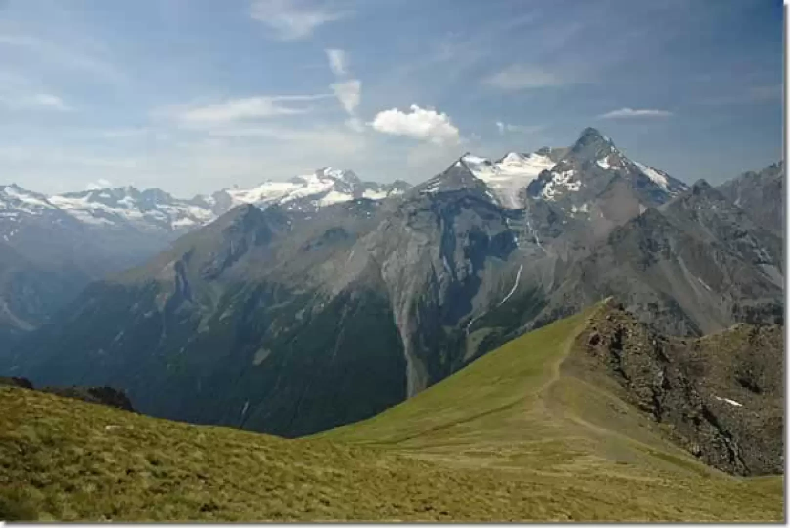
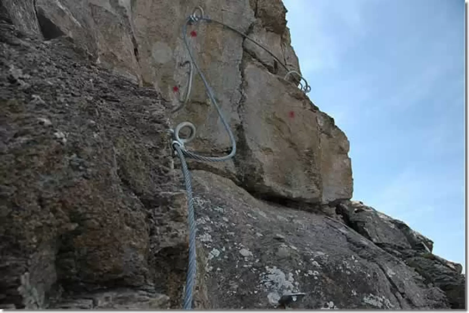
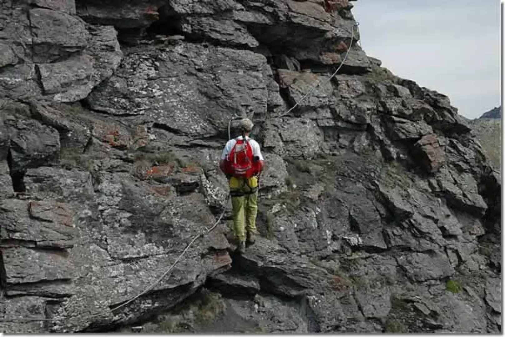
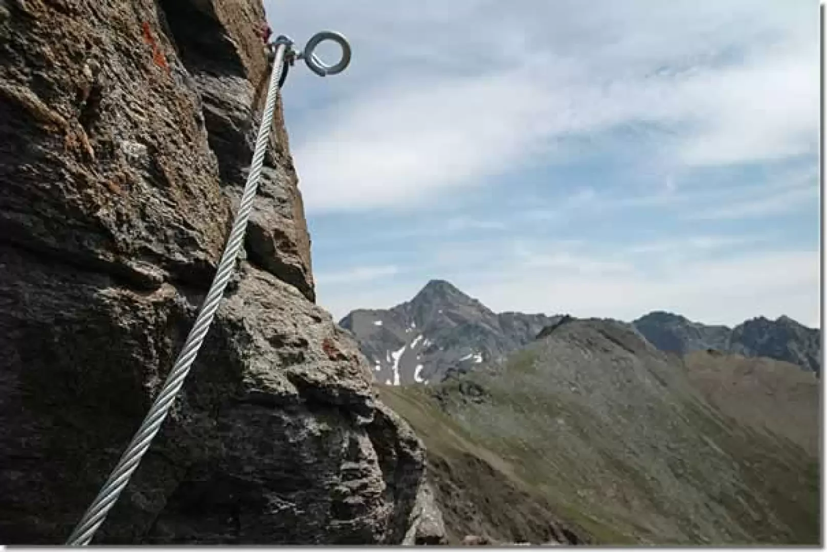
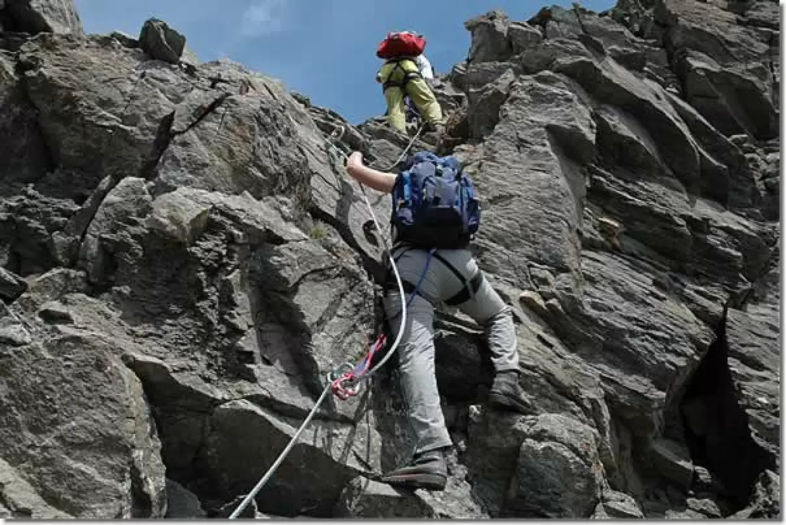
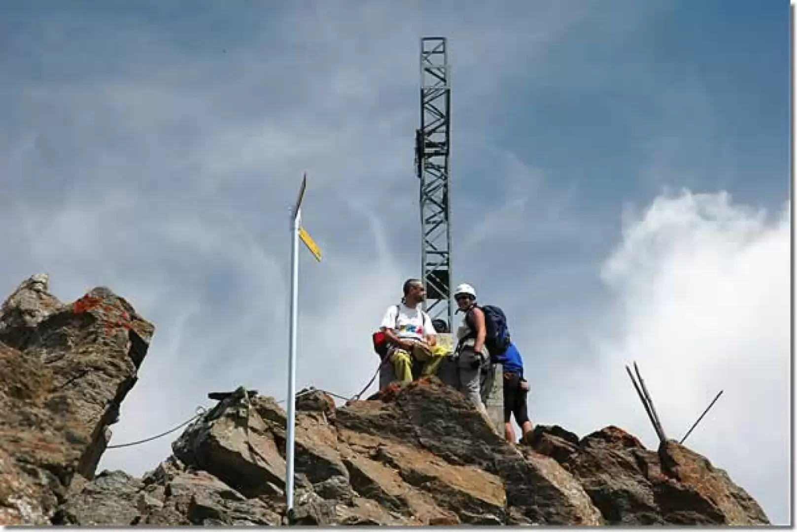
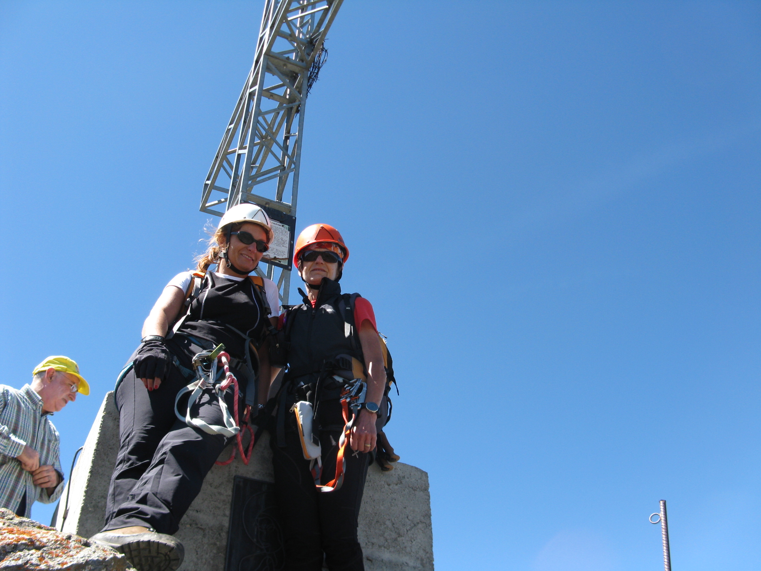
Leaving the car in the convenient car park, we set off towards the start of the chairlift. The climb takes about a quarter of an hour and leads to Chamolé (2310m): the starting point of the first part of the walk. After admiring the Cristo di Chamolé, a wooden sculpture by Mario Stuffer, proceed to the right, passing near the Bar Chamolé and taking the little road downhill. Follow the road, signposted (19C), ignoring several intersections, as far as the departure point of the Couis 1 chairlift (2169m, 0h20'): take it to reach the watershed ridge between the Pila basin and the Cogne valley. Leaving the chairlift, turn left and immediately come across the signpost for the Sentiero Panorama, marker (7). Proceed along a comfortable little path that traces the watershed ridge, immediately offering marvellous views: the name given to the path is entirely appropriate. We ascend in sequence the peaks of Platta de Grevon (2753 m), Pointe de Montpers (2794 m) and Pointe de Chasèche (2824 m) with a series of ups and downs accompanied by a few steel handrails. After reaching the last elevation, we descend to the Chasèche pass (2815m, 1h20'). From the pass, the Sentiero path (19A) climbs a grassy ridge from which there is a splendid view of Gran Paradiso and Grivola. After reaching the top of the ridge, the landscape before us changes: rocks and small rocks become part of the path. Immediately afterwards, the route begins, equipped with a series of cables useful for a short descent. After setting up the harness, via ferrata kit and helmet, the via ferrata can begin. A short descent is made and then a small rocky spur is climbed: it is descended again with a passage that is not too easy. The route continues towards the summit, climbing up the ridge on slightly inclined rocky slabs; some passages are a little airy but nothing particularly difficult. Along the route, there are also a few stretches of path between small rocks until reaching the base of the summit; climb up the latter, crossing large boulders. By now, the equipped route is coming to an end: all that is missing is the ascent to Punta Valletta, which rises above us with its evident cross. A few short climbs are overcome and we finally reach the summit of Punta Valletta (3090m, 2h50'). From the summit, the view is exceptional and, above all, you have a privileged vantage point of the nearby peaks of Punta Garin, Mont Emilius and Becca di Nona.
Descent
The descent is along the normal route up to Punta Valletta. One begins to descend the point on a path with a few stone crossings until reaching the grassy ridge. The descent leaves on the right the modest relief of Mont Belleface (2968 m, 3h20') and then descends towards the small plateau preceding the Tête Noire (2820 m, 4h00'). Along the descent one can appreciate the splendid view of the Arbolle valley with its small lakes and the Refuge. Once at the Tête Noire one proceeds to a severe descent towards the col de Chamolé (2641 m, 4h20'): the path descends steeply with a series of rapid turns that put feet and ankles to the test. On reaching the pass, descend towards the Chamolé lake (2325 m, 4h40') on the beautiful path that is reached with a series of twists and turns. The hike comes to an end; in a few minutes of almost flat path, you reach Chamolé (2310 m, 4h50') and the chairlift for the return to Pila. For information on timetables and costs of the ski lifts, consult the website of the Associazione Valdostana Impianti a Fune. Bibliography
- Dario Gardiol, Le Vie Ferrate volume 2, L'Arciere editore, Dronero (Cn), 2006
- O. Pecchio, Escursioni e vie ferrate in Valle d'Aosta, Quart - Aosta, 2004
Galleria fotografica