Tête de la Tronche, from the Villair


Edited by:
Giancarlo Beretta
Updated at: 11/02/2026
Access
Navigazione stradale
Lasciare lo svincolo autostradale di Aosta Ovest e procedere in direzione nord-est per 35m (0,04km). Prendere lo svincolo per la e proseguire per 900m (0,94km) fino alla rotatoria. Alla rotatoria, prendere la seconda uscita e imboccare la strada statale della Valle d’Aosta. Proseguire per 4,3km (5,24km) fino alla successiva rotatoria. Alla rotatoria, prendere la prima uscita e rimanere sulla per 550m (5,79km). Svoltare leggermente a destra per rimanere sulla e proseguire per 3,7km (9,49km). Alla rotatoria, prendere la prima uscita e continuare sulla per 2,2km (11,69km). Alla rotatoria successiva, prendere la seconda uscita e rimanere sulla per 14,1km (25,79km). Proseguire dritto sulla e continuare per 4,4km (30,19km) fino a raggiungere una rotatoria. Alla rotatoria, prendere la seconda uscita e rimanere sulla per 800m (30,99km). Svoltare leggermente a destra e imboccare Vicolo Dolonne, proseguire per 140m (31,13km) attraversando la rotatoria. Mantenere la sinistra e continuare su Strada Margherita per 42m (31,17km). Svoltare a sinistra e imboccare Via Circonvallazione, proseguire per 210m (31,38km). Continuare su Viale Monte Bianco per 300m (31,68km). Alla rotatoria, prendere la seconda uscita e imboccare Strada Sergio Viotto, proseguire per 170m (31,85km). Svoltare a destra e imboccare Strada Adolphe Rey, proseguire per 160m (32,01km). Continuare su Strada Grand Ru per 260m (32,27km). Svoltare a sinistra e imboccare Strada del Villair, proseguire per 600m (32,87km). Continuare su Via – Rue Val Sapin per 550m (33,42km) fino a raggiungere la località Raffort, dove si trova il parcheggio.
Descrizione del parcheggio
In località Raffort si trova un parcheggio 🅿️ gratuito al termine della strada comunale, nei pressi dell’abitato. Il parcheggio costituisce il punto di partenza dell’itinerario. La disponibilità di posti è limitata; si raccomanda di parcheggiare senza intralciare la viabilità locale.
Accesso con mezzi pubblici
La località di Courmayeur è servita da autobus di linea gestiti da Arriva Valle d’Aosta. Raffort non è tuttavia direttamente servita da fermate dedicate; prevedere un trasferimento a piedi dal centro di Courmayeur. Verificare preventivamente orari e frequenze, che possono variare nei periodi festivi o stagionali.
Distanza e tempo di percorrenza
🕒 Tempo di percorrenza: 42 minuti
📏 Distanza: 33,42km
Navigazione GPS
📍 Come arrivare con Google Maps
📍 Come arrivare con Apple Maps
ℹ️ Nota importante
Le indicazioni fornite sono state verificate alla data del rilievo dell’itinerario. Prima della partenza si consiglia di verificare possibili variazioni del percorso o delle condizioni stradali. Per informazioni aggiornate si raccomanda di consultare Google Maps o Apple Maps.
Introduction
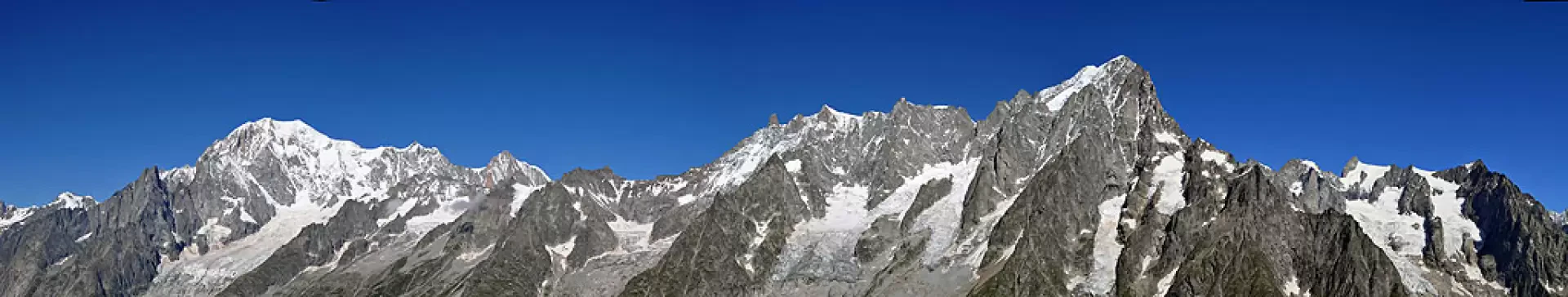
Classic 'loop' of the Courmayeur area for lovers of scenery, which, from the summit and for much of the return journey, affords stupendous views of glaciers, peaks and walls, especially of nearby Mont Blanc and Grandes Jorasses. Indispensable is binoculars and a map for better identification of huts, bivouacs and the various ascent routes that have made mountaineering history.
Description
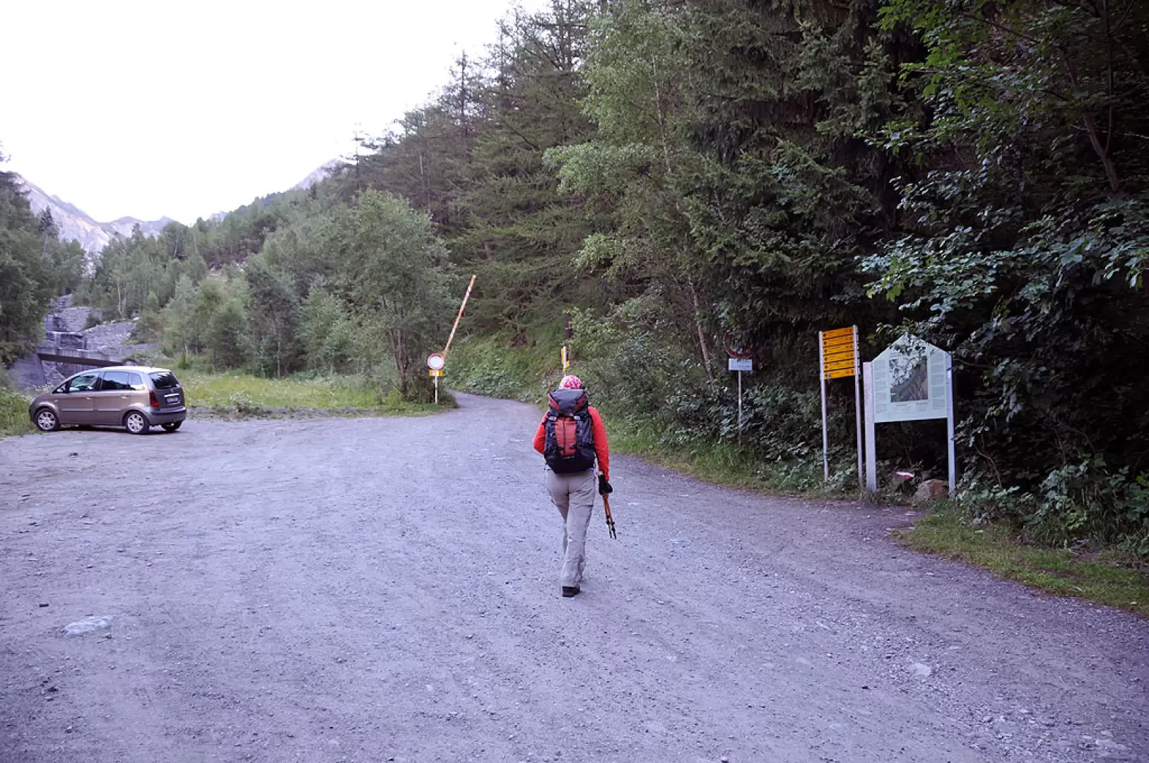
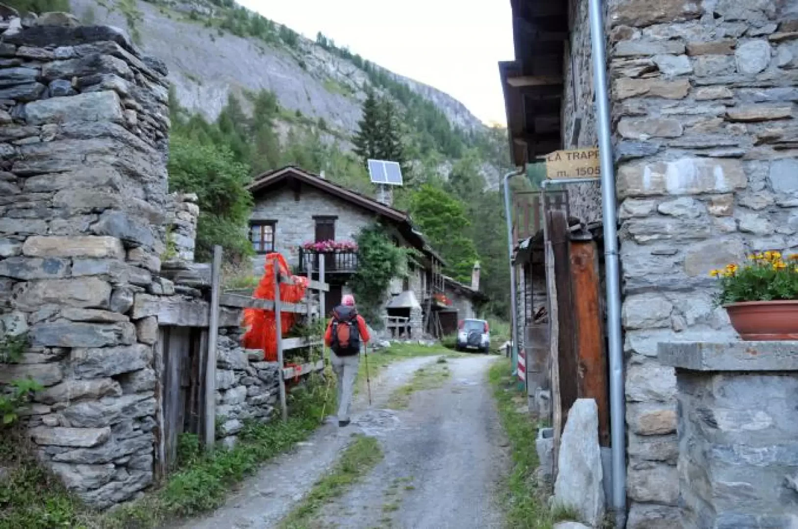
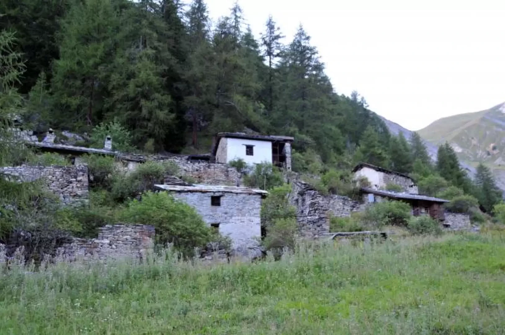
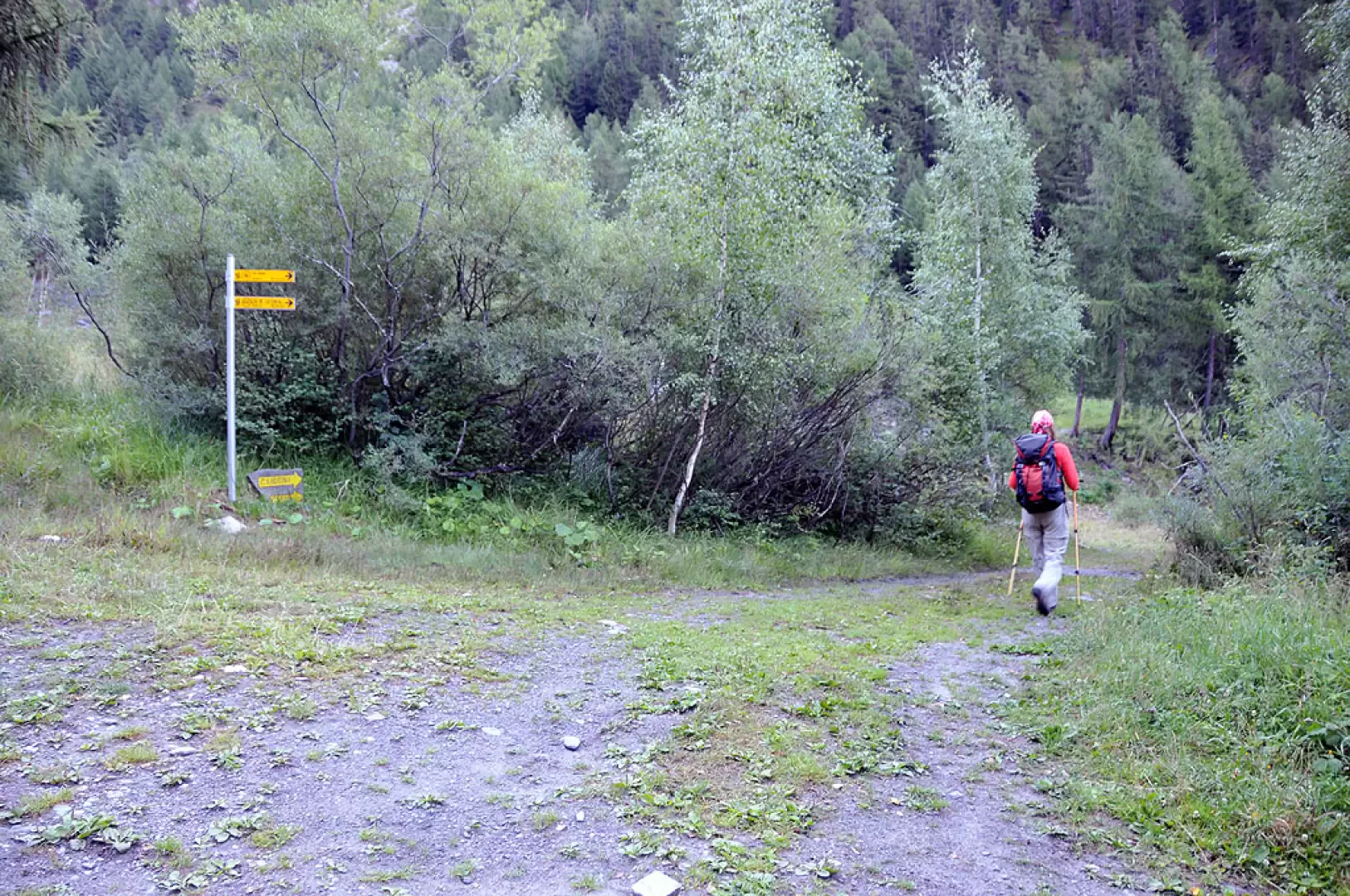
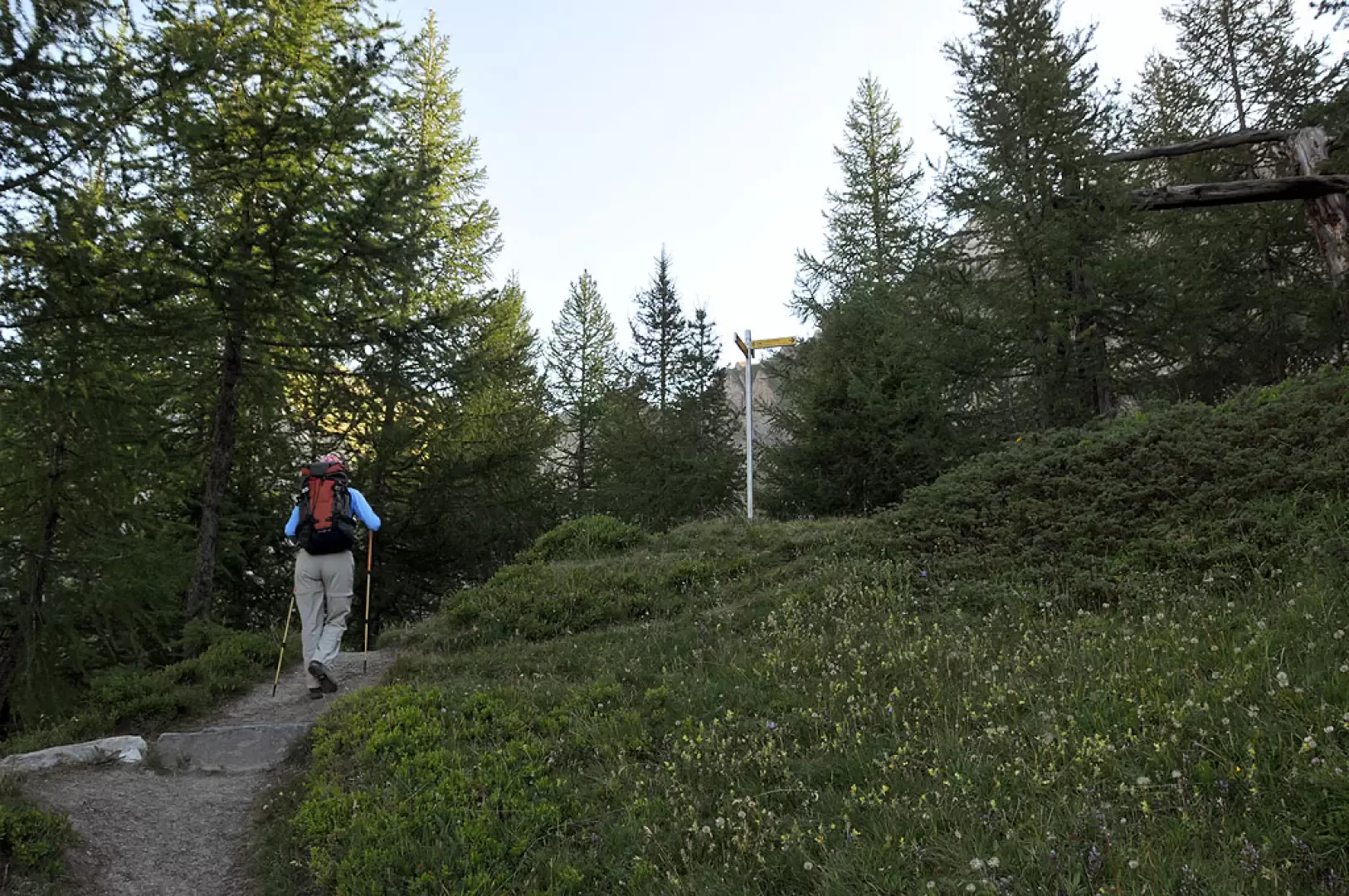
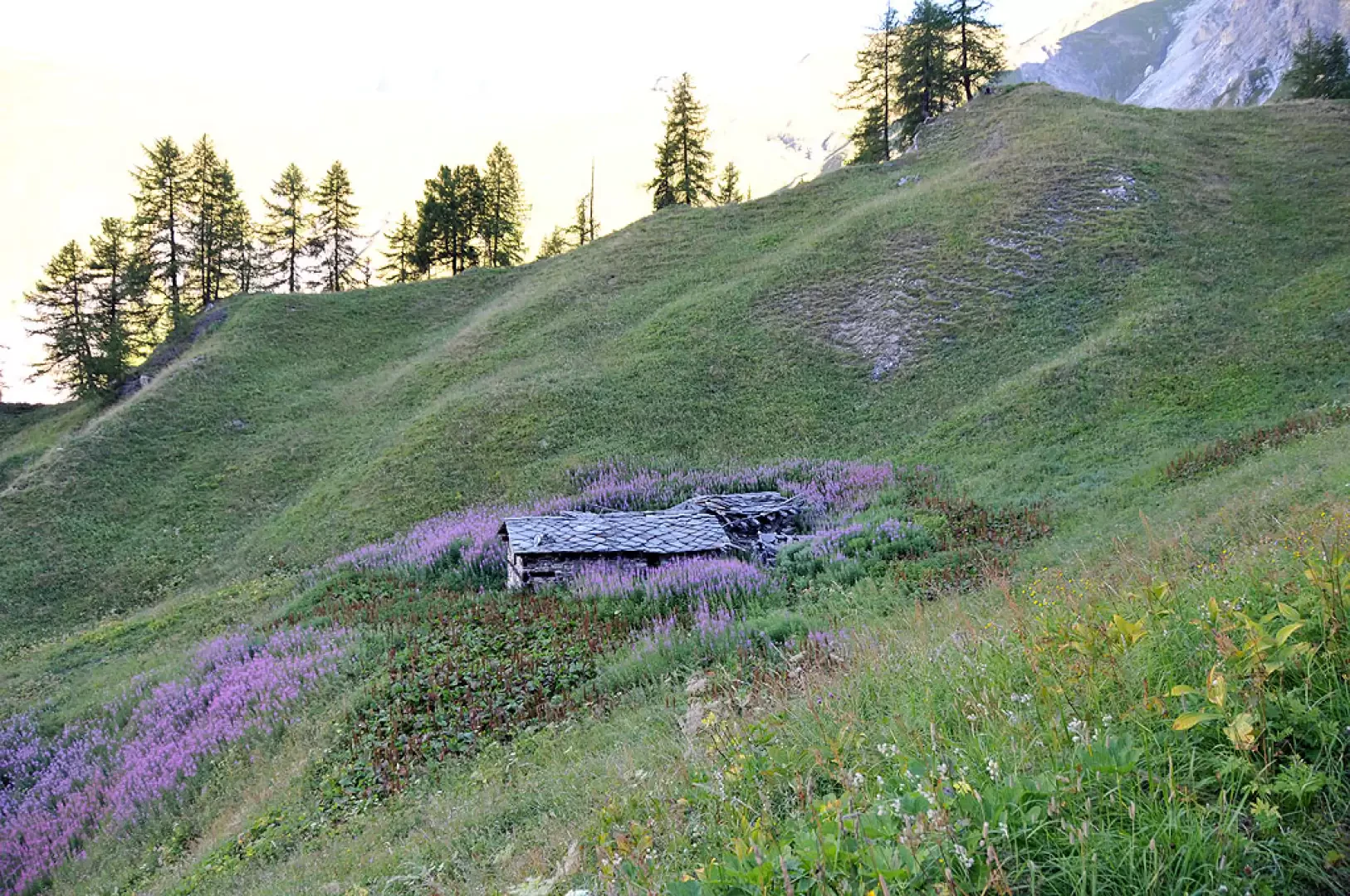
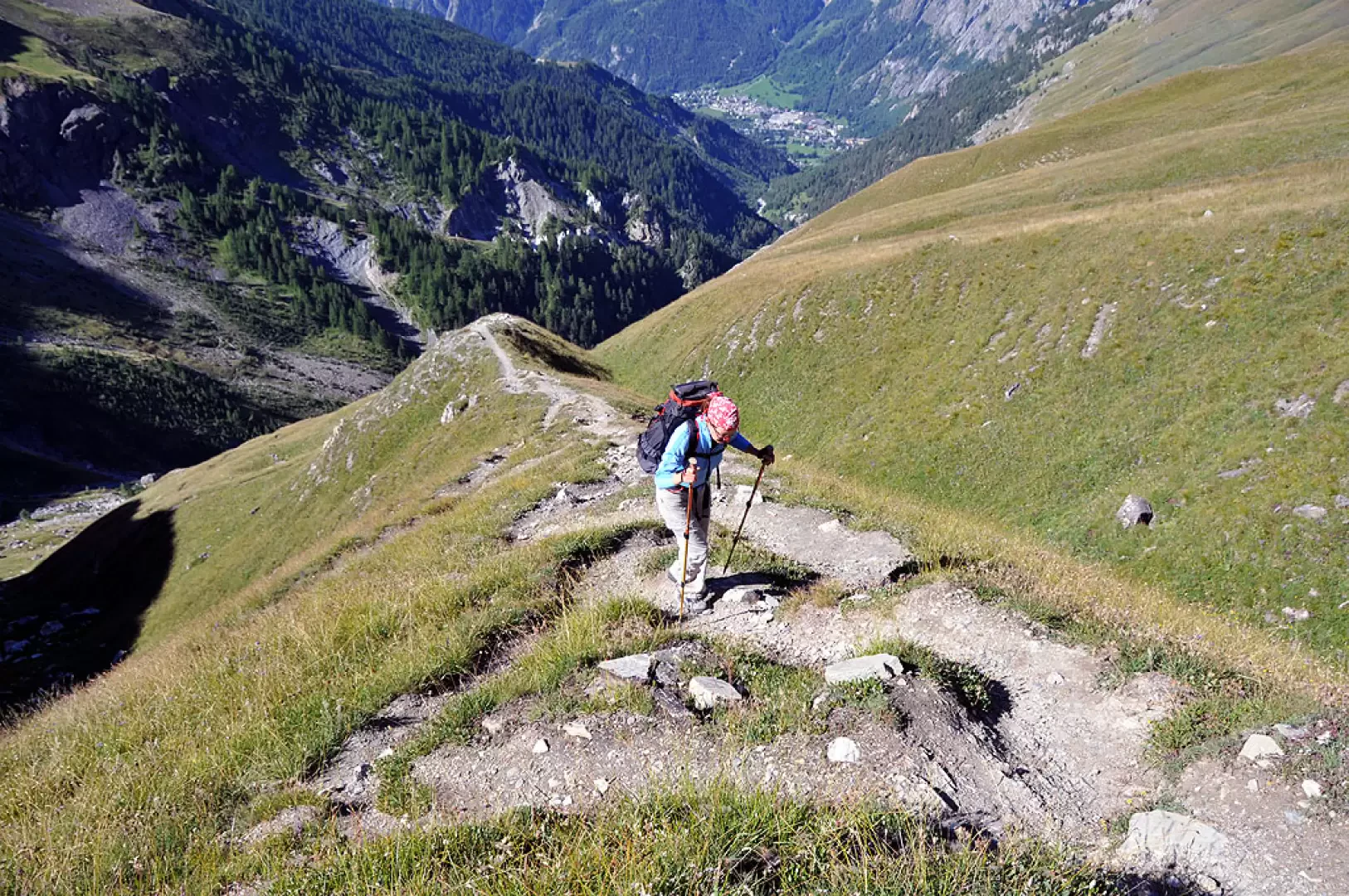
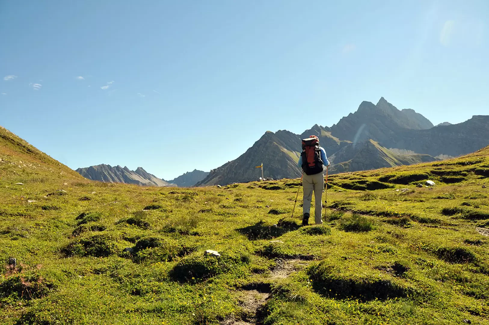
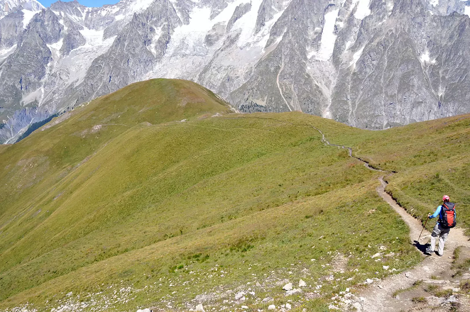
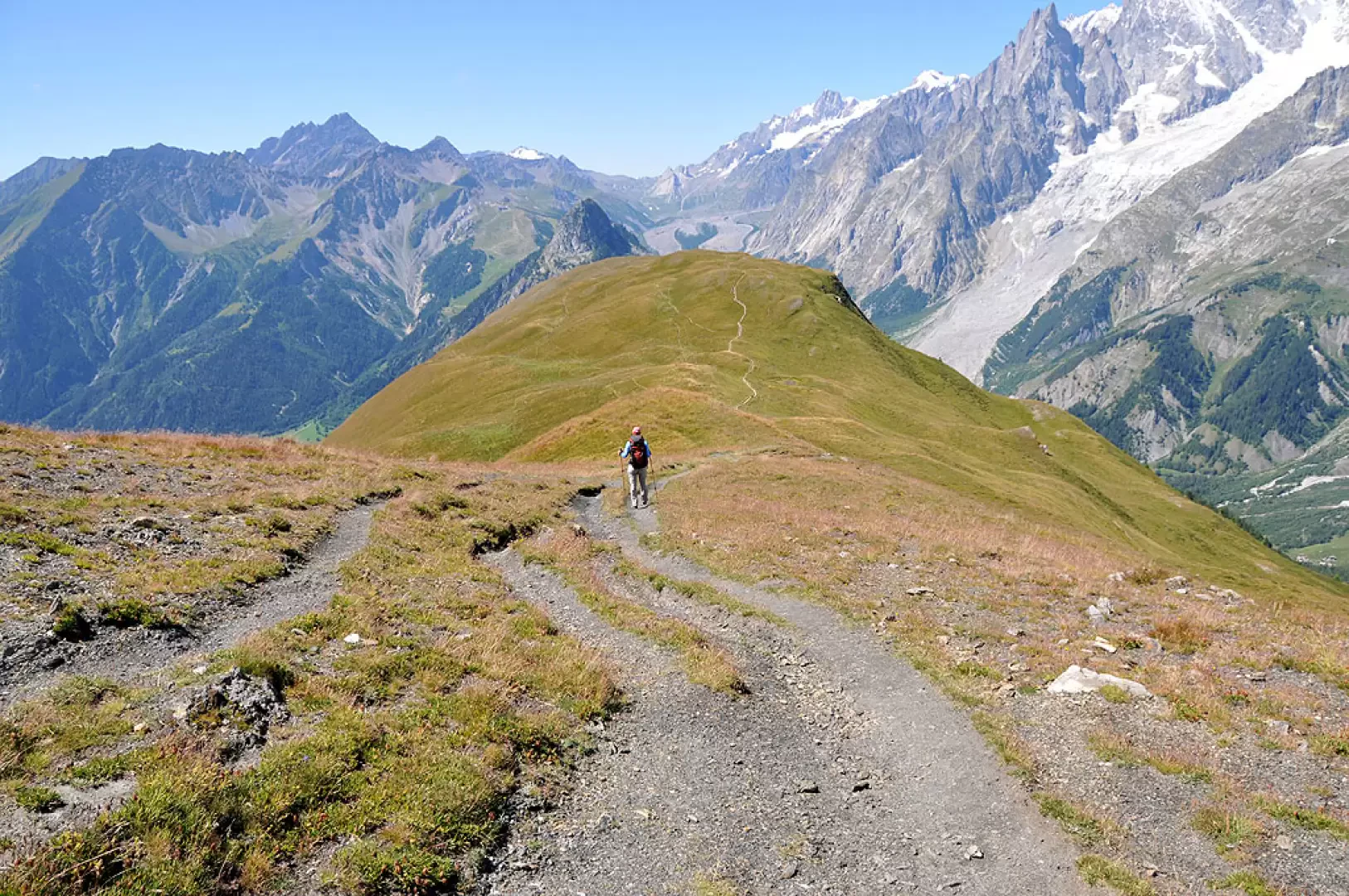
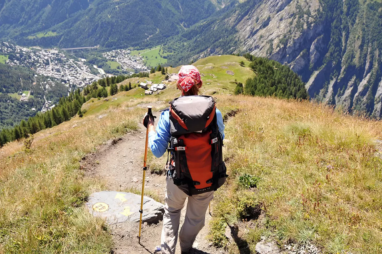
From the car park, continue along the farm track that, having immediately crossed a stream, rises with comfortable hairpin bends to the left (orographic right) of Val Sapin. The path to Rifugio Bertone is left off to the left, and continues without an excessive incline through the village of La Trappe (1505m) to Tsapy (1619m), where the track ends and where our destination can already be seen at the bottom of the valley. In front of the houses, the path branches off to the right, well signposted with a post and with indications also on a stone, which climbs in hairpin bends in the forest with a gradient that increases considerably. Immediately gaining height, climb up a ridge and then, coming out of the wood for a little while, go around it and climb up again until reaching a fork for La Suche, which you leave to the right, as shortly afterwards also the fork for the Licony pass, signposted by a small pole. During this part of the ascent, the immaculate peaks of Mont Blanc and the Grandes Jorasses begin to peep out, giving us a foretaste of what the view will be like once we reach the summit. Just beyond this, the path loses altitude for a few metres and crosses a stream to continue with a few ups and downs on the level, skirting the lower slopes of the Tête de Licony. Go over a scarcely marked col, pass a short scree area and cross one last stream, heading above the old Curru mountain pasture (1964m); after another half-steep traverse, the slope increases considerably to climb in hairpin bends up the steep pastures that descend from Col Sapin, which is reached by laboriously crossing the edge of a small grassy moraine at its end. Once at Col Sapin, take the track to the left, which, with a less accentuated slope, allows us to reach the summit of the Tête de la Tronche in little more than ten minutes. The panorama is truly breathtaking and is guaranteed to be so for a good part of the descent: the Mont Blanc chain, from the Aiguille des Glaciers to Mont Dolent, is right nearby and in front of us on the opposite side of the Val Ferret below. For the descent, the route starts at the summit and follows the obvious track that descends northwards, heads for a col and makes a traverse halfway up the slope below the summit of Testa Bernarda. After a short descent, we continue towards the undulations of the green ridge of Mont de la Saxe, which we cross with numerous ups and downs: in this section it is worth pausing again to enjoy the views of the Mont Blanc chain seen from another angle. At the end of the grassy rises, the descent begins, a little steep, towards a col where an orientation board is located and just below is the Rifugio Bertone (1977m). Now, just in front of the hut, the track descends into the forest wide and comfortable with numerous hairpin bends that, with a moderate gradient, lead to the crossroads on the farmstead passed on the way up and, turning right, you soon find yourself back at the starting point.
Photo gallery
Comments (0)
Sign in to leave a comment