Vescoz Arboretum, circular walk from Plan d'Arey

Edited by:
Massimo Martini
Updated at: 14/07/2026
Access
Road directions
At the motorway at Châtillon-Saint-Vincent, follow the signs for Chambave along Via Emilio Chanoux and Via L.F. Menabrea for 1.7 km until you reach the roundabout. Take the third exit and join the (1.7 km). Continue on the for 4.9 km, then take the exit for Centro Chambave / Verrayes / Saint-Denis (6.6 km). Turn right onto the and continue for 230 metres (6.8 km). Turn left to stay on the and continue for 300 metres (7.1 km). Turn right to continue on the and drive for 1.9 km (9.0 km). Turn left to stay on the and continue for 4.1 km (13.1 km). Turn slightly left onto the towards Plan Verrayes and continue for 190m (13.3km). Turn slightly right towards the hamlet of Plan d’Arey and drive 200m to the car park at the end of the tarmac road.
Car park
At the end of the tarmac road there is a free 🅿️ car park with a few parking spaces.
Access by public transport
To reach the starting point of the route, you will need a private vehicle, as the area is not served by public transport.
Distance and journey time
🕒 Journey time: 23 minutes
📏 Distance: 13.6 km
GPS navigation
Important information
The directions provided were verified on the date the route was mapped. Before setting off, we recommend checking for any changes to the route or road conditions. For up-to-date information, please consult Google Maps or Apple Maps.
Introduction
A circular route that follows the paths within the “Abbé P. L. Vescoz” Arboretum, a woodland area created between 1905 and 1908 by Canon Pierre-Louis Vescoz on the Pointys promontory, in the municipality of Verrayes, in the Central Valley. The route starts from the hamlet of Plan d’Arey, climbs through the mixed woodland to the upper edge of the hill and returns via an alternative route on the same slope.
The arboretum — the oldest in the Aosta Valley — is home to several thousand specimens of non-native species planted as part of an experimental reforestation project: cedars from three different sources, Douglas firs, giant sequoias, beech and oak. Although the latter two species are found elsewhere in the Aosta Valley, they were not widespread in the Verrayes area at the time of planting. The topography of the area is varied: the wooded section gradually gives way to a more open, arid area, where small herbaceous species grow, including thyme, red cephalanthera and alpine daphne. The lower edge of the area runs alongside the gorge carved out by the Crétaz stream, with signs of gully erosion visible on the opposite slope.
The route is accessible all year round; spring is the best time to observe the herbaceous plants in bloom. The route follows a dirt track and woodland paths, with a moderate elevation gain and low hiking difficulty. The arboretum’s internal network is complex and features numerous junctions: signposts and information boards mark the main route but not all side paths. It is advisable to check the topographical map at the entrance.
Description
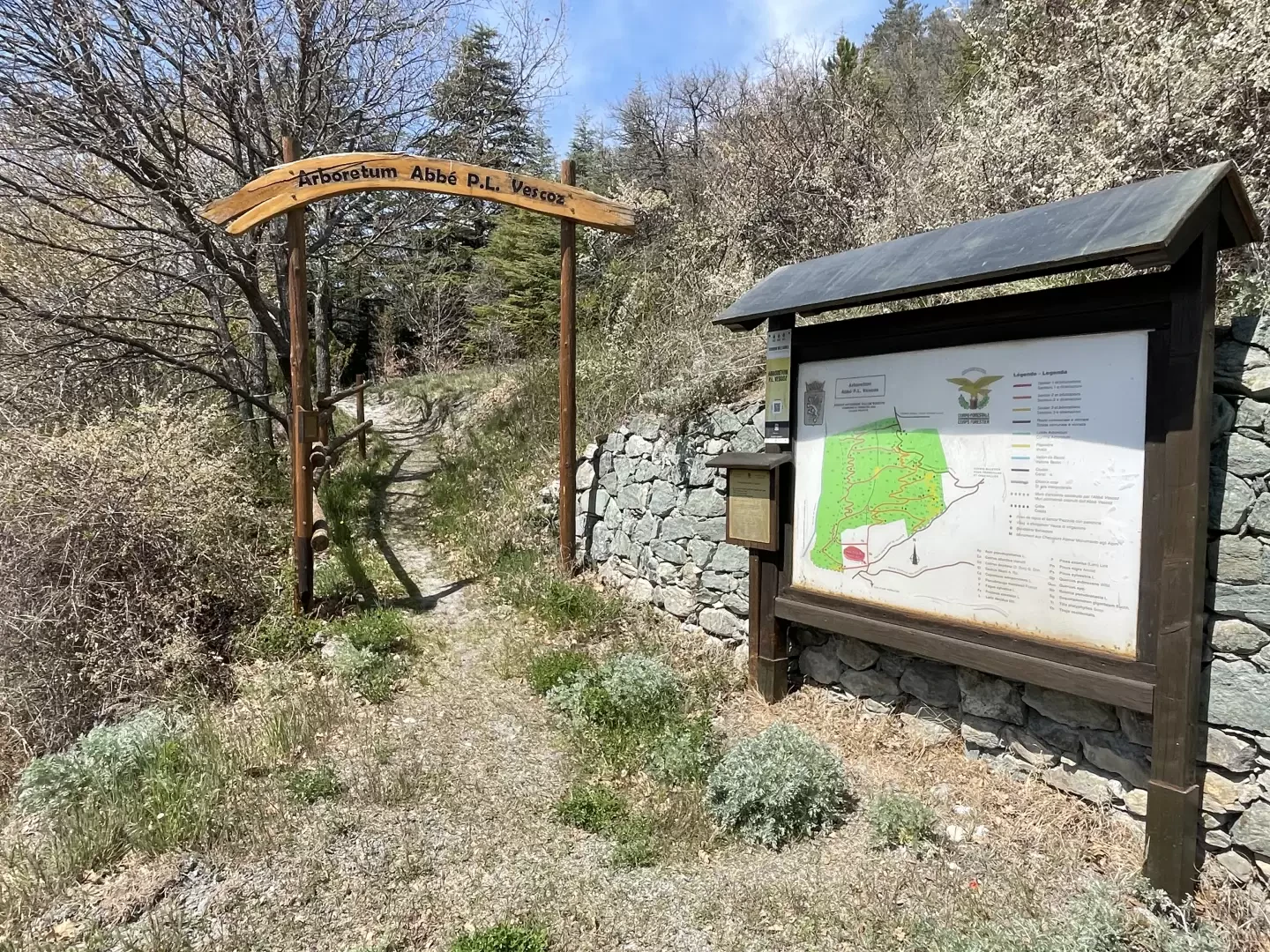
[0h00’T1] 0.00 km From the unpaved car park at Plan d’Arey (1,031 m), take the narrow unpaved track that runs westwards on level ground, signposted by a dark wooden arrow with white lettering. After about 200m, turn sharply right to reach the information board at the entrance to the arboretum, which shows the layout of the paths inside.
[0h10’T2] 0.20 km From the entrance, follow the path on the left, which runs alongside the perimeter fence. Pass close to the building situated above a canal and continue to the western edge of the area, where the path begins to climb the slope.
[0h20’T2] 0.35 km Zigzag northwards, ignoring the side paths amongst the trees bearing identification signs. The vegetation includes Douglas firs (Pseudotsuga menziesii), cedars and, standing alone, a giant sequoia (Sequoiadendron giganteum). Along a path protected by fences, the woodland gives way to a more open and arid area, featuring thyme (Thymus), red helleborine (Cephalanthera rubra) and, according to the site’s botanical descriptions, alpine daphne (Daphne alpina). Reach the edge of the gorge carved out by the Crétaz stream, where the calanchi-style erosion features on the opposite slope are visible, and continue to the panoramic clearing where the monument to the Alpini stands (1,200 m) [0h45’T2] 0.65 km (170 m elevation gain) (0 m elevation loss).
From the upper viewing point, take the path down. Descend the slope until you rejoin the ascent route near the information board, then follow the dirt track back to the Plan d’Arey car park (1,031 m) [1h10’T2] 1.30 km (170 m elevation gain) (170 m elevation loss).
Places of Interest
“Abbe’ P. L. Vescoz"
Verrayes
Comments (0)
Sign in to leave a comment