Banff National Park

Edited by:
Massimo Martini
Access
Banff National Park is crossed by two main roads. From the east, the Trans-Canada Highway (Highway 1) links Calgary – home to the nearest international airport – to the park’s eastern entrance, some 100 km from the city. From here, it continues to Banff and Lake Louise and, to the west, reaches Yoho National Park and British Columbia. Between Banff and Lake Louise, Highway 1A (Bow Valley Parkway) runs parallel to the Trans-Canada Highway along the Bow Valley. From the south, Highway 93 (Banff–Windermere Parkway) comes from Radium Hot Springs through Kootenay National Park and joins the Trans-Canada at Castle Junction. North of Lake Louise, Highway 93 becomes the Icefields Parkway and leads to Jasper after approximately 230 km. At Saskatchewan River Crossing, Highway 11 (David Thompson Highway) links the park to Rocky Mountain House and central Alberta. Stopping within the park requires a permit from Parks Canada; this is not required for transit only. Public transport includes bus services from Calgary and the Roam network, which serves Banff, Canmore and Lake Louise. The road to Moraine Lake is closed to private vehicles: the lake can be reached by Parks Canada shuttle buses (bookable in advance) or by authorised commercial operators.
Introduction
Banff National Park, in the Canadian province of Alberta, is Canada’s first national park. Established in 1885 as a reserve around the hot springs of the Bow Valley, it was granted national park status in 1887. Today it covers 6,641 km² along the eastern flank of the continental divide of the Rocky Mountains. It borders Jasper National Park to the north, Yoho National Park to the west and Kootenay National Park to the south: together with these parks, it has formed part of the UNESCO Canadian Rocky Mountain Parks site since 1984. The territory reaches its highest point at 3,612 metres on Mount Forbes and features a mix of U-shaped glacial valleys, glacial lakes and icefields stretching along the border with British Columbia. One of the park’s distinctive features is the system of wildlife overpasses and underpasses built along the Trans-Canada Highway, which reduces the fragmentation of large mammals’ habitats.
Description
The park stretches for approximately 240 km along the continental divide, which forms its western boundary. The mountain ranges follow the north-west/south-east orientation of the Canadian Rockies. To the west lie the Main Ranges, along which the continental divide runs, comprising the Waputik, Bow and Blue ranges. To the east lie the Front Ranges, comprising the Palliser, Sawback and Sundance ranges, within which lies the town of Banff. The main hydrographic axis is the Bow Valley. The river rises from the Bow Glacier on the Wapta Icefield and flows through the park from north-west to south-east, passing through Lake Louise and Banff. Beyond Bow Summit (2,088 m), the highest point reached by a public road in Canada, the waters flow down the Mistaya to Saskatchewan River Crossing, where they join the North Saskatchewan. The northern part of the park extends to the Columbia Icefield, on the border with Jasper National Park. The largest natural lake is Hector Lake, whilst Lake Minnewanka, near Banff, is the main reservoir regulated by dams.
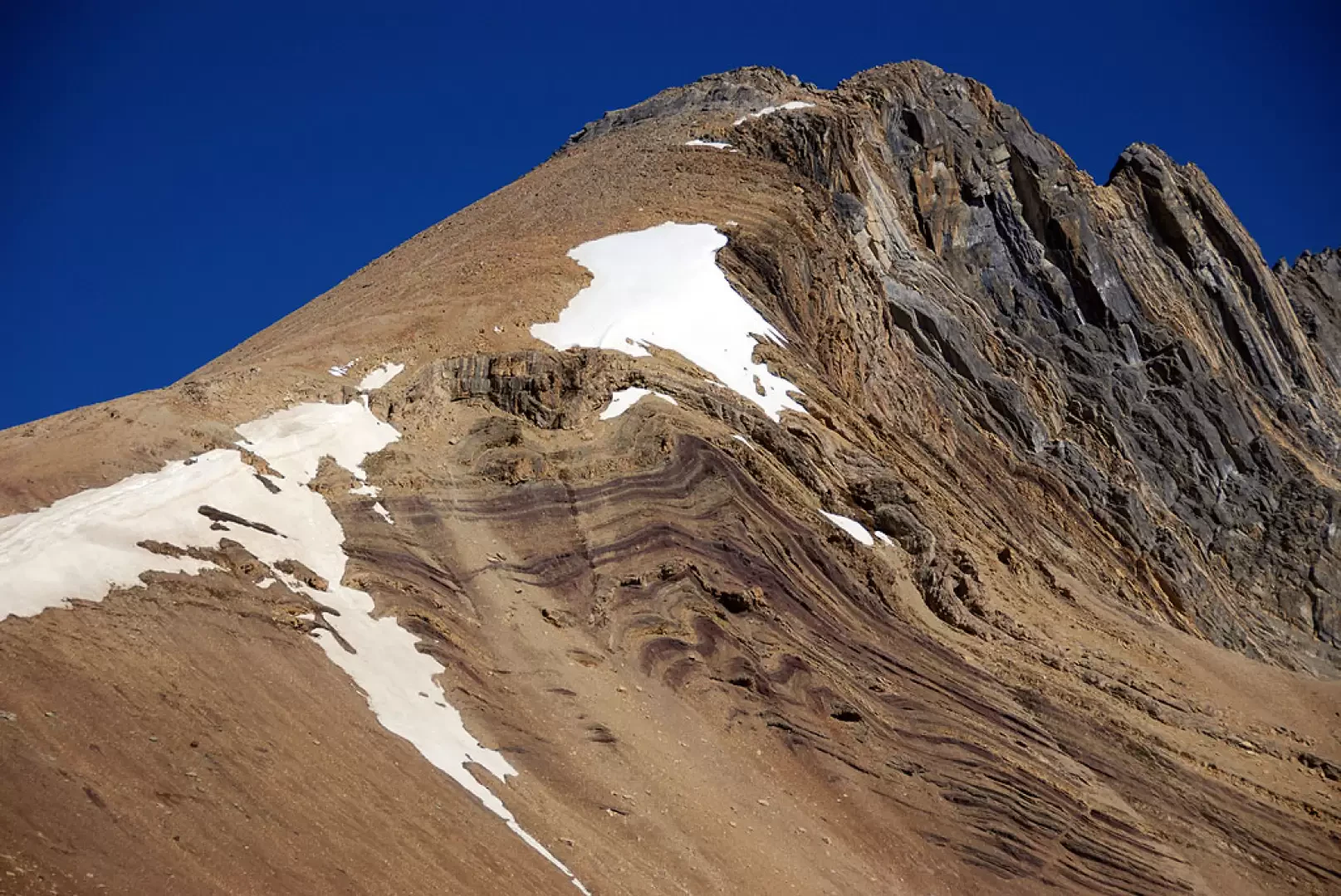
The park’s mountains are composed of sedimentary rocks: claystones, sandstones, dolomites and limestones. These strata were deposited on the floor of shallow seas between 600 and 175 million years ago. During the Laramide orogeny, which ended around 55 million years ago, they were thrust eastwards over more recent strata. The westward dip of the strata, at an angle of 40–60°, makes the eastern and northern slopes steeper and gives the landforms their distinctive shapes: Mount Rundle, near Banff, is a buttress mountain; Castle Mountain displays the superimposition of Cambrian formations of varying hardness; the Sawback Range, with its almost vertical strata, features jagged ridges. Quaternary glaciations have sculpted cirques, ridges, hanging valleys, moraines and U-shaped valleys. The park’s glaciers are retreating. Between 1985 and 2005, 29 out of 365 glaciers disappeared and the glacial area fell from 625 km² to 500 km². The Peyto Glacier, which has been continuously monitored since the 1970s, has lost around 70 per cent of its volume.
The park comprises three ecoregions. The montane ecoregion, at lower altitudes, covers 3 per cent of the area. It is dominated by lodgepole pine (Pinus contorta), alongside Engelmann spruce (Picea engelmannii), willows, American aspen (Populus tremuloides) and sporadic specimens of Douglas fir (Pseudotsuga menziesii). Thesubalpine ecoregion covers 53 per cent of the territory and consists mainly of dense forest of Engelmann spruce and subalpine fir (Abies lasiocarpa), with patches of contorted pine. Towards the tree line, the subalpine larch (Larix lyallii) appears, whose foliage turns yellow between September and October. Beyond the tree line, at around 2,300 metres, lies the Alpine ecoregion, covering 27 per cent of the area, comprising high-altitude grasslands, scree and glaciers.
A total of 53 species of mammals have been recorded in the park. Predators include the grizzly bear (Ursus arctos), theblack bear (Ursus americanus), the puma (Puma concolor), the Canadian lynx (Lynx canadensis), the wolverine (Gulo gulo) and the grey wolf (Canis lupus). The wolf returned to the Bow Valley in 1985, after an absence of around thirty years due to culling campaigns. The valley floors are home to the wapiti (Cervus canadensis), introduced in 1917 with specimens from Yellowstone, and themoose (Alces alces). At alpine altitudes, the snow goat (Oreamnos americanus) and the Rocky Mountain sheep (Ovis canadensis) are widespread. The American bison (Bison bison), which had disappeared from the area in the19th century, was reintroduced in 2017 to the eastern section of the park. The caribou (Rangifer tarandus), on the other hand, has been locally extinct since 2009, when an avalanche swept away the last remaining individuals. The birdlife comprises 315 observed species, including the golden eagle (Aquila chrysaetos), the white-headed sea eagle (Haliaeetus leucocephalus) and, in the alpine meadows, the white-tailed ptarmigan (Lagopus leucura). The harsh winters limit the herpetofauna to one toad, three frogs, one salamander and two snakes. The Banff Springs snail (Physella johnsoni), an endangered species, lives in the hot springs. The native fish fauna, which includes the char (Salvelinus confluentus), has been adversely affected by the introduction of non-native species.
Human presence in the area has been documented for over 10,000 years through the Vermilion Lakes archaeological finds. Before contact with Europeans, the territory was inhabited by several Indigenous nations, including the Stoney Nakoda, Ktunaxa, Tsuut’ina, Kainai, Piikani, Siksika and the Plains Cree. Several place names, such as Minnewanka and Waputik, derive from the Stoney language. In 1885, to resolve disputes over the discovery and commercial exploitation of the hot springs, the federal government established a 26 km² public reserve around Cave and Basin. The Rocky Mountains Park Act of 23 June 1887 expanded it to 674 km² under the name Rocky Mountains Park. The boundary was extended in 1902 to 11,400 km² and reduced in 1911 to 4,663 km², under pressure from pastoral and forestry interests. Following further amendments, the National Parks Act of 1930 assigned the park its current name. With minor adjustments up until 1949, the area was finalised at its current size. Between 1890 and 1920, the Stoney Nakoda were removed from the park’s territory. The 1988 amendment to the National Parks Act established the protection of ecological integrity as a management priority, entrusted to Parks Canada. The town of Banff, incorporated as a municipality in 1990, remains subject to federal park legislation regarding planning and building development.
The park comprises seven national historic sites. Cave and Basin, in Banff, preserves the cave and hot spring from which the park originated, a site of cultural and spiritual significance for the Stoney Nakoda. Since 2013, it has housed a pavilion dedicated to the First World War internment camps, the main one of which was situated at the foot of Castle Mountain. The Banff Park Museum, a log-clad building completed in 1903, displays botanical and zoological collections from the early 20th century. The Banff Springs Hotel, built by the Canadian Pacific Railway in the Scottish baronial style and completed in 1928, is the only one of the seven sites not managed by Parks Canada. Higher up are the Skoki Ski Lodge, built in 1930–31 and considered the first commercial building in Canada designed for skiers, and the site of the Sulphur Mountain Cosmic Ray Station, which commemorates Canada’s participation in theInternational Geophysical Year 1957–58. The list is rounded off by Howse Pass and the Abbot Pass Refuge Cabin. The latter was a stone refuge built in 1922 by Swiss guides, at 2,925 metres on the watershed between Mount Victoria and Mount Lefroy. In 2022, it was dismantled due to the instability of the slope: a section of wall, the commemorative plaque and the stone steps remain on site. On the slopes of Cascade Mountain, the remains of Bankhead, a mining village active between 1903 and 1922, can also be found.
The hiking network comprises over 1,600 km of maintained trails. The main starting points are located around Banff and Lake Louise and along the Icefields Parkway, from where numerous routes lead to glacial lakes, passes and peaks that can be reached without mountaineering skills. Overnight stays along the trails are permitted in designated camping areas, subject to a permit from Parks Canada. The Alpine Club of Canada has been organising climbs, hikes and camps in the park since 1906. Within the park there are three ski resorts – Sunshine Village, Mount Norquay and Lake Louise – and a via ferrata on Mount Norquay, served by a chairlift in summer.
Information
General information
Type: National Park; IUCN Category II (National Park)
Year established: 1885 (Banff Hot Springs Reserve); 1887 (Rocky Mountains Park Act); current name: 1930 (National Parks Act)
Managing body: Parks Canada
Responsible authority: Federal Government of Canada
Area: 6,641 km²
Minimum altitude: n/a
Maximum altitude: 3,612 m
Highest point: 3,612 m – Mount Forbes
Region: Alberta
Municipalities involved: Banff
Official website: https://parks.canada.ca/pn-np/ab/banff
Points of interest
Territory